What Happened
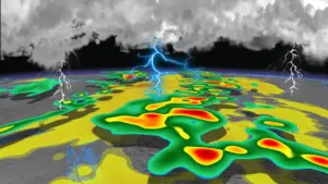
Tropical Cyclone Horacio rapidly intensified over the southwest Indian Ocean, becoming the first Category 5 tropical cyclone of 2026. The storm reached peak winds of approximately 160 mph (257 km/h) on February 23, 2026, before beginning to weaken as it moved over cooler waters, according to reports from the Joint Typhoon Warning Center (JTWC) and meteorologists.
Why It Matters
Horacio’s development highlights the ongoing risks posed by tropical cyclones, particularly in the context of climate patterns such as El Niño, which may influence future storm activity. Although currently not a threat to land, the cyclone serves as a reminder of the potential severity of weather systems as the Atlantic hurricane season approaches.
What’s Next
Forecasts indicate that Horacio will continue to weaken over the next 48 hours due to increasing dry air and vertical wind shear. The storm is expected to slow down and shift west-southwestward as it loses intensity. While it poses no immediate threat to land, marine interests should remain vigilant as the cyclone transitions over open waters.