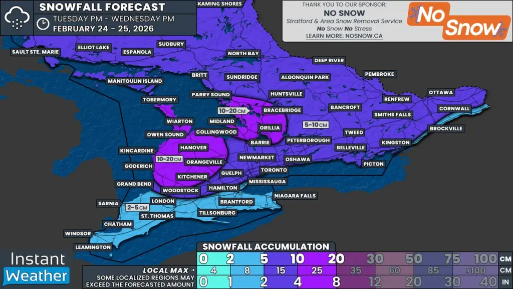
What Happened
As February draws to a close, Southern Ontario is bracing for significant weather changes due to an Alberta Clipper system expected to move through the region overnight Tuesday into Wednesday. This weather event is forecasted to bring widespread snowfall, with accumulations generally ranging from 5 to 10 cm, and localized areas potentially receiving up to 15 cm.
Why It Matters
The timing of this snowfall coincides with the Wednesday morning commute, which raises concerns about travel conditions. Roads are likely to be snow-covered during peak traffic hours, with limited time for snow removal crews to clear and treat surfaces. Additionally, wind gusts of 40 to 60 km/h may lead to blowing snow, further reducing visibility and creating hazardous driving conditions, particularly in exposed areas such as those east of Lake Huron and around Georgian Bay.
What’s Next
In addition to the initial snowfall, lake effect snow is expected to redevelop throughout Wednesday, particularly in traditional snowbelt communities. This could result in another round of heavier snow squalls in the afternoon. Due to these conditions, some school boards may consider canceling bus services, although the decision will depend on how quickly road crews can manage the snow and the actual conditions at the time of decision-making.